

Enclave Territory of India and Bangladesh

What is Enclave Territory :
Enclave refers to an area or territory which is an isolated area within the mainland of an independent state and belongs to another independent state. Many countries in the world have such enclaves within other states.
- Enclave territory between India and Bangladesh:
Prior to August 1, 2015, there were a total of 162 enclaves of Bangladesh within India and India within Bangladesh. At 12:01 pm on August 1, the two countries exchanged their enclaves within each other under the historic Mujib-Indira pact. Bangladesh got a total of 111 enclaves including 59 in Lalmonirhat, 36 in Panchagarh, 12 in Kurigram, and 4 in Nilphamari. On the other hand, 51 enclaves of Bangladesh were located in the Indian state of West Bengal. Of these, 47 were located in Cooch Behar and 4 in the Jalpaiguri districts.
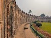
 |
| Enclave territory between Cochbehar District of West Bengal India and Bangladesh. |
There are some famous enclave territories between India and Bangladesh-
1. Dashiyarchhara -
 |
| Enclave territory |
A notable enclave, in this case, was Dashiarchhara, the enclave of India in Kurigram, Bangladesh. Inside Dashiarchhara there is an enclave of Bangladesh called Chandrakhana which remains in Bangladesh. It was the only enclave in the world to have another within another country.
2. Dahagram-Angarpota and South Berubari -
 |
| India Bangladesh enclave territory |
The name of the very famous Dahagram-Angarpota enclave is known to many - this enclave belongs to Bangladesh, but it is surrounded by Indian territory. As a result, the people here are practically imprisoned in jail. Many days later, on June 26, 1992, India leased 3 bighas of the corridor. In return, India occupied the southern half of the South Berubari Union No. 12 and adjoining areas.
- What is the history of this enclave?
One thing is for sure - most of these enclaves were part of the ancient state of Cooch Behar. And this is the condition of these areas since the Mughal period. Rumor has it that at that time the king of Cooch Behar and the king of Rangpur used to exchange these areas as prizes for playing dice. As a result, many areas became part of the state of Cooch Behar which is actually in Rangpur, and vice versa.
 |
| Migrant people during the division |
- The reason for the creation of the enclave?
In 1947, Lord Mountbatten planned to draw the border between Bengal and Punjab. According to his plan, a demarcation commission was formed that year, headed by British lawyer Cyril Radcliffe. Radcliffe came to India from London on 7 July 1947. In just six weeks, on 13 August, he gave the final report on the demarcation. Three days later, on 16 August, the border map was released to the public.
 |
| Sir Cyril Radcliffe |
Sir Cyril Radcliffe drew maps of India and Pakistan. The areas he identified with East Pakistan are now the territory of Bangladesh. Radcliffe did not realize the real problem when drawing the boundary line. As a result, the boundaries of the Radcliffe are changed in many places. In many places the territory of Bangladesh is occupied by India and the territory of India is occupied by Bangladesh. Those occupied territories are called sub-occupied lands.
 |
| Sir Radcliffe drew maps of India and East Pakistan |
- Nun-Nehru Agreement 1956 :
Within a year of the partition of the country, the enclave issue revealed the suppressed communal tensions between India and Pakistan. Opposition parties in India strongly opposed the decision of the Prime Minister of India Jawaharlal Nehru and the Prime Minister of Pakistan Feroze Khan Noon to hand over part of the enclave of South Berubari (6.39 sq km) between the two countries to East Bengal in 1956. It was decided that in order to connect the Angarpota-Dahagram enclave under Patgram police station of Nilphamari district with the mainland of East Bengal, India could acquire another piece of land adjoining the enclave in exchange for one acre of land known as 'Three Bighas'. But when the fight started in India, this decision could not be implemented even for two decades.
 |
| Nehru and Liaquat Ali Khan Agreement |
- Mujib-Indira agreement 1974 :
The border agreement between Bangladesh and India was signed in 1974 which is known as the Mujib-Indira agreement. Although Bangladesh ratified the agreement at that time, India did not do so then. Then in 2011, the protocol was signed with the border agreement. To amend the border agreement between Bangladesh and India, including the protocol, it was necessary to amend the Constitution of India. The current government of Indian Prime Minister Narendra Modi has been able to reach a unanimous vote in the country's parliament to amend the constitution. After that, the way was opened for the implementation of the border agreement with the protocol and the implementation of the border agreement took place at midnight on 31st July.
.webp "Mujib_Indira_agreement_1974") |
| Mujib Indira agreement 1974 |
- Sub-occupied land exchange :
In the light of the border agreement, the joint survey team of the two countries kept the space occupied by them and turned the border a little. As a result, the map changes at the border. Thus, in the light of Radcliffe's map, 226.62 acres of Indian land were occupied by Bangladesh in six places. So as a result of this agreement Bangladesh got 226.72 acres of land. In contrast, India occupied 26,034 acres of land in 12 places along the border. Which is now occupied by India.
 |
| Sub-occupied land exchange |
- Unresolved boundaries :
There are more than four thousand kilometers of land borders between Bangladesh and India. Six and a half kilometers of the land border was unmarked. Members of a joint survey team from the two countries have identified a four-and-a-half-kilometer border between Daikhada in the north and Lathitila in the east. As a result, maps of these two places were confirmed. However, it was not possible to mark the 2 km boundary at Muhuri Char in the Bilnia sector of Feni district. The Muhuri River is considered to be the boundary line between the two countries. But it was not possible to identify the midstream. As a result, this little obstacle remained in the way of the full implementation of the border agreement.

Meanwhile, the joint survey officers of the two countries prepared more than eleven hundred strip maps for the preparation of new maps by changing the maps. To sign them, the Plenipotentiary signed by Bangladesh's High Commissioner to India Syed Moazzem Ali and India's High Commissioner to Bangladesh Pankaj Saran. Bangladesh and India got a new map through this signature.
.webp "Piller_no17") |
| Piller No 17 |


0 Comments